


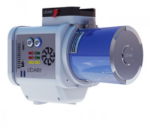
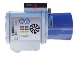
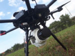
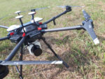
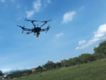
LiDARit Eagle X fits perfectly for people who needs to scan extensive ranges in the LiDAR business, offers high-quality, with the better performance.
It is our highest performance system, up to 100 hectares per flight in a conventional Drone such as the DJI M600pro or up to 800ha / hour in another platforms.
LiDARit Manager software is included in all our systems, allows total control of the projects, from LiDAR scan to the processing and generation of deliverables, No long learning curve, no expensive training, no hire processing personnel and no expensive software.
PLATFORM
- Range: 200m (656ft) @10%
- Recommended Scan Heighta: 140m (459,3ft)
- Recommended Distance between linesa: 140m (459,3ft)
- Point Cloud RMSE @ 50m: 25mm
- Point Cloud RMSE @ 100m: 35mm
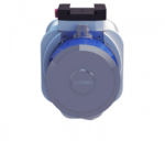
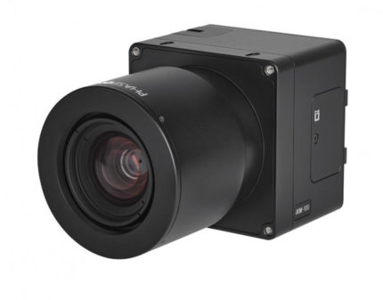
LIDAR SENSOR
- Laser: 40 Channels.
- Number of echoes: 2
- Scanning method: Mechanical rotation
- Laser class: Class 1 Eye Safe
- Pulses: 720k/s
- Field of view: 360o*40o
- Rotation rate: 10Hz – 20Hz.
- Resolution: 0.02*1
- Point density at 70m (flat terrain)b: 139p/m2
NAVIGATION SYSTEM
- Constellation support: GPS, GLONASS, BEIDOU, GALILEO
- Support Alignment: Static, Kinematic,dual antenna
- Operation mode: Real-time and postprocessing
- Accuracy Position: 1cm + 1ppm RMS horizontal
- Heading RMSE: 0.009/0.019° IMU options.
- Position accuracy: ± 1cm.
- Roll and pitch accuracy: 0,006°
- Data rate: 120Hz
Reviews
There are no reviews yet.